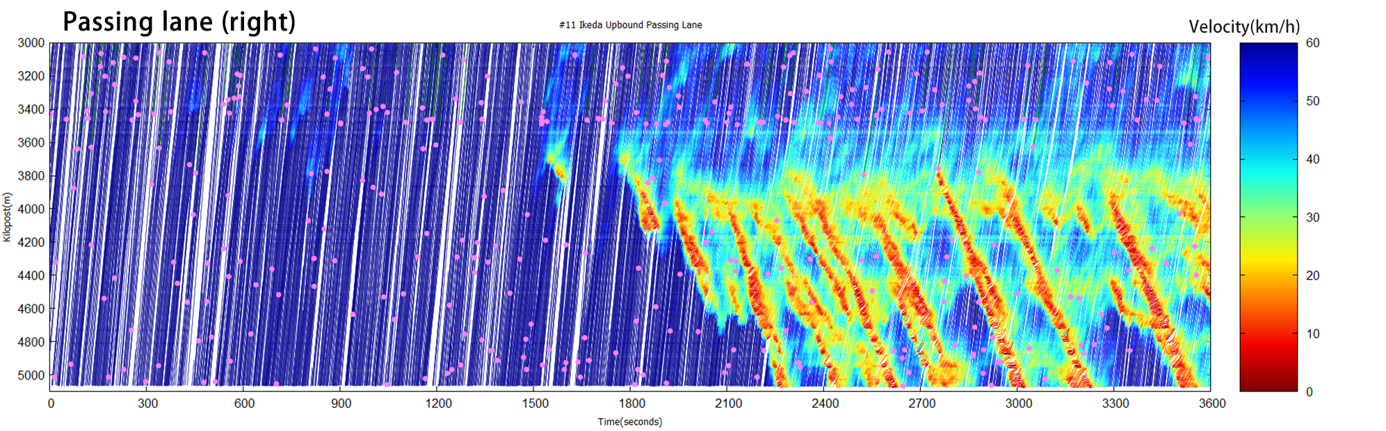
Hanshin Expressway Route 11 (Ikeda Route Osaka bound) nearby the Tsukamoto Junction
Overview of the target sections
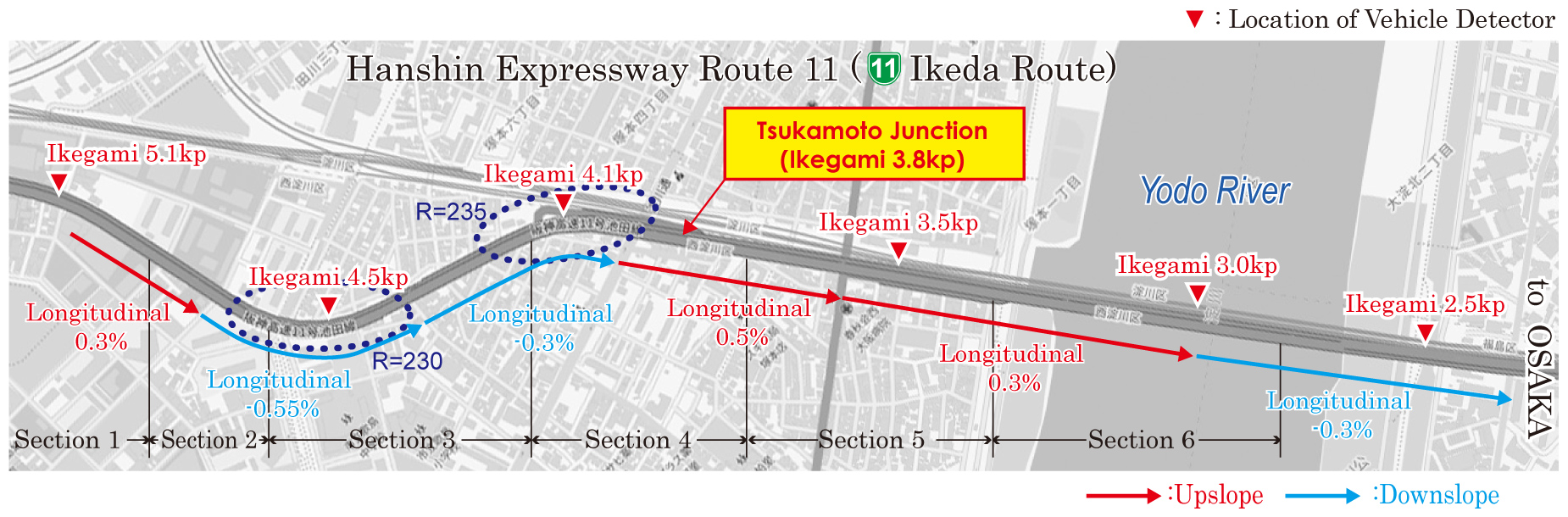
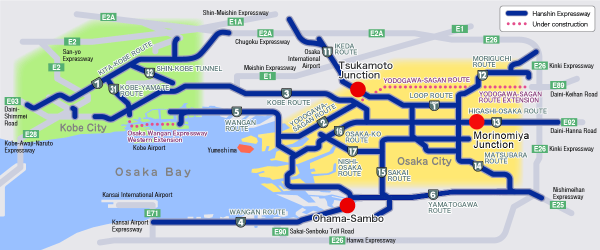
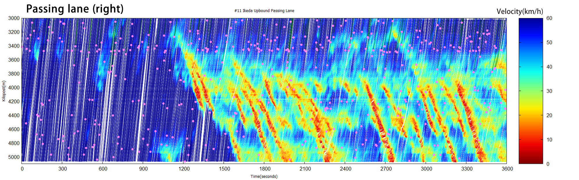
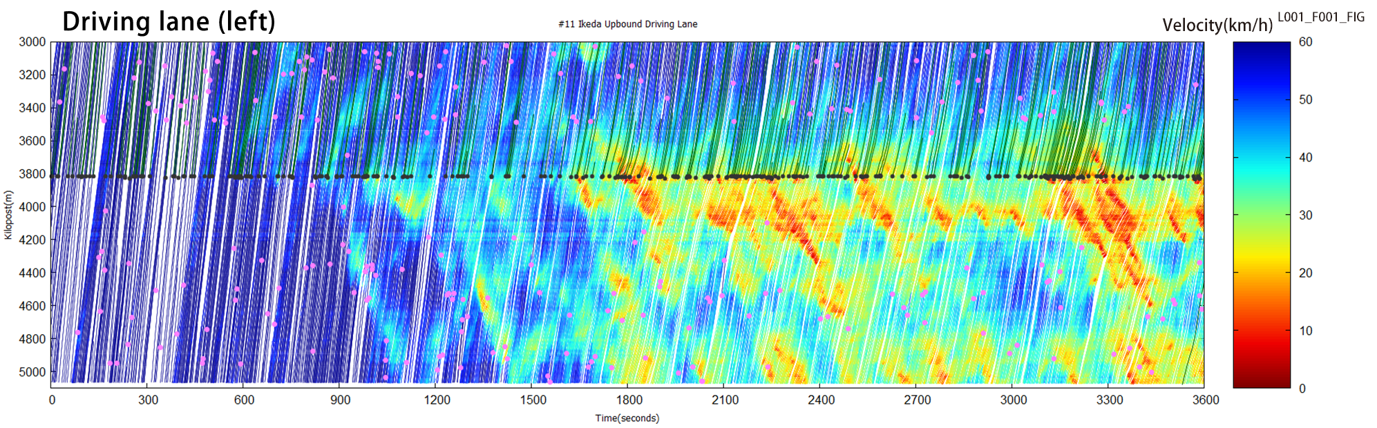
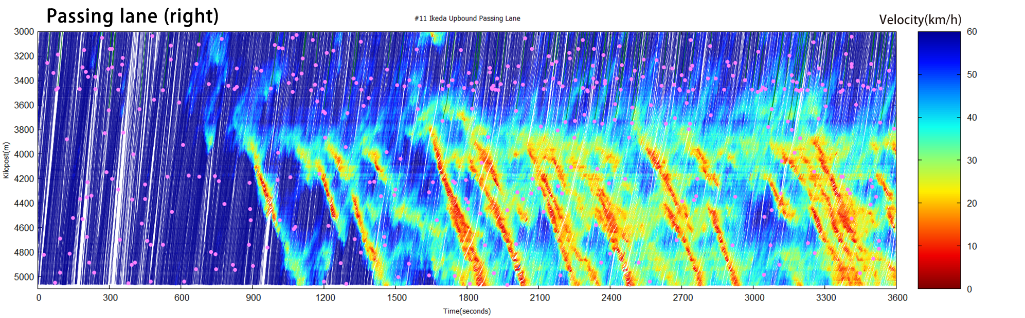
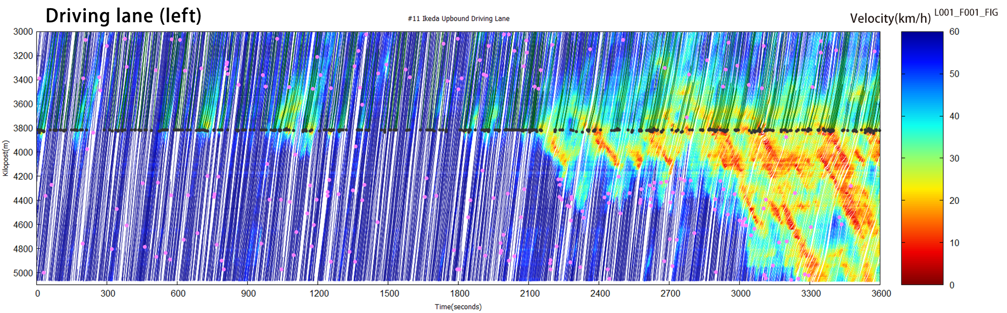
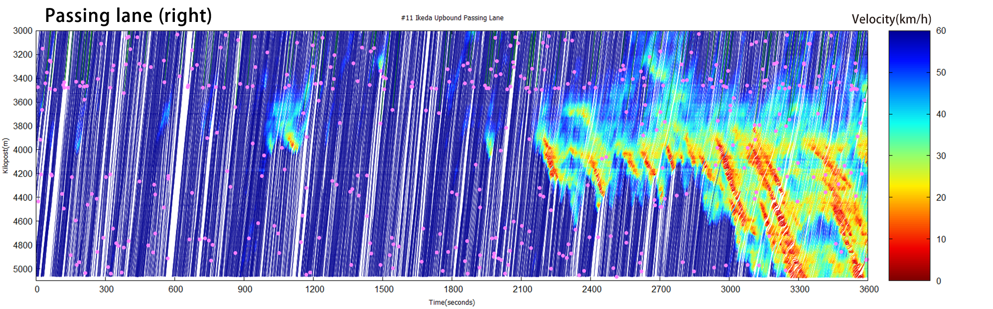
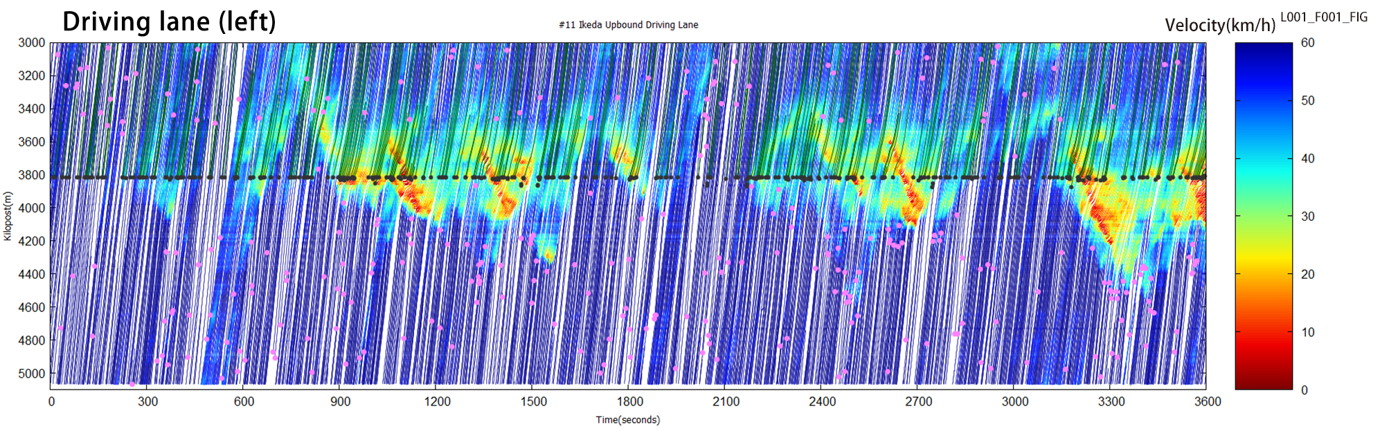
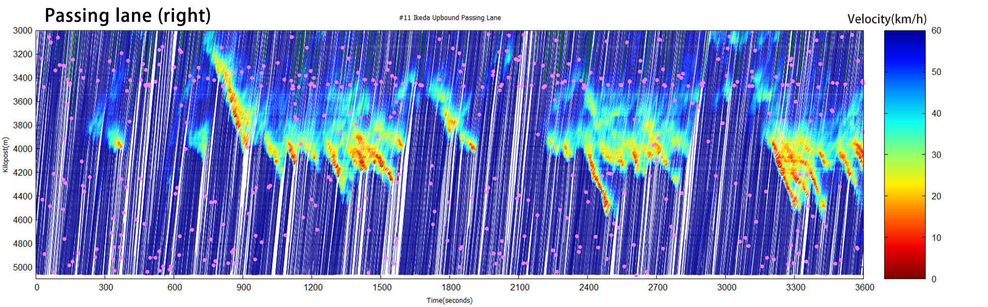
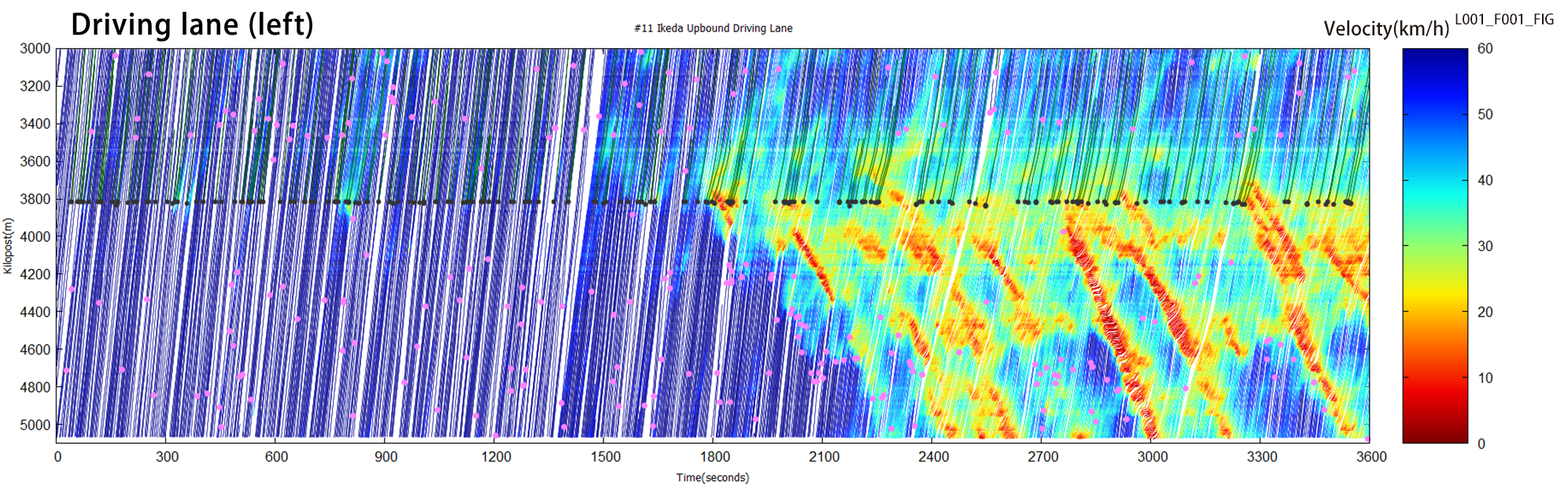
The Hanshin Expressway Route 11 (Ikeda Route) is one of the major routes that connect the Osaka International (Itami) Airport (ITM), Meishin and Chugoku Expressways, and other trunk routes with Osaka City. The Tsukamoto Junction (Osaka bound) is located on the right bank of the Yodo River, outskirts of Osaka city center. Roads around the junction carry a large amount of traffic with two lanes for each direction with a complicated road environment with S-shaped curves, sags, and Tsukamoto interchange. Shock waves frequently occur at convergences, curves, and the bridge over the Yodo River.
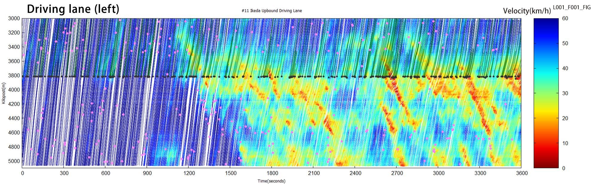
Traffic conditions in the time-space diagram
Recreated drivers’ and
birds’ views
[Driver’s view video]
[Birds’ view video]
Traffic conditions in the time-space diagram
Recreated drivers’ and
birds’ views
[Driver’s view video]
[Birds’ view video]
Traffic conditions in the time-space diagram
Recreated drivers’ and
birds’ views
[Driver’s view video]
[Birds’ view video]
Traffic conditions in the time-space diagram
Recreated drivers’ and
birds’ views
[Driver’s view video]
[Birds’ view video]
Traffic conditions in the time-space diagram
Recreated drivers’ and
birds’ views
[Driver’s view video]
[Birds’ view video]
* These time-space diagrams display the traffic conditions of the five sets of one-hour “Vehicle trajectory database.”
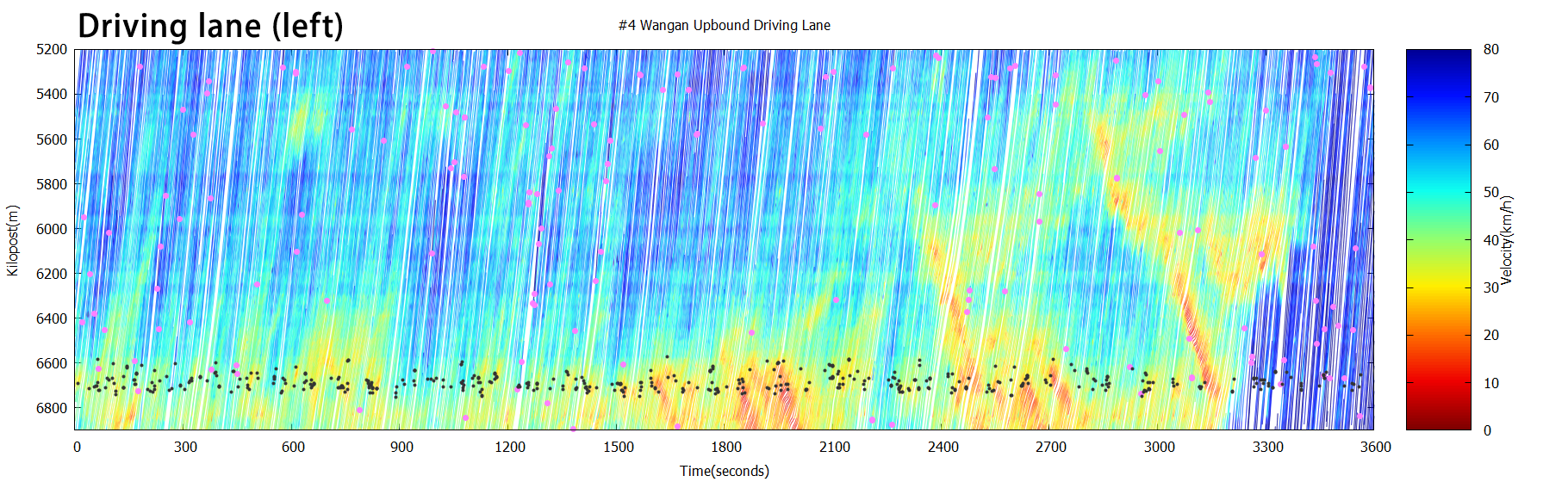
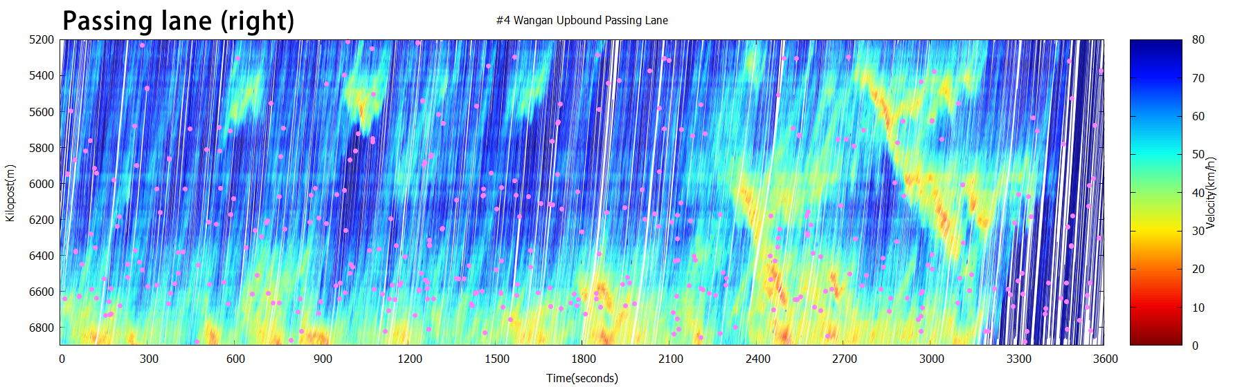
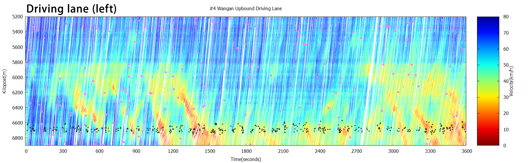
Hanshin Expressway Route 4 (Wangan Route Osaka bound) at the Ohama-Sambo section
Overview of the target sections
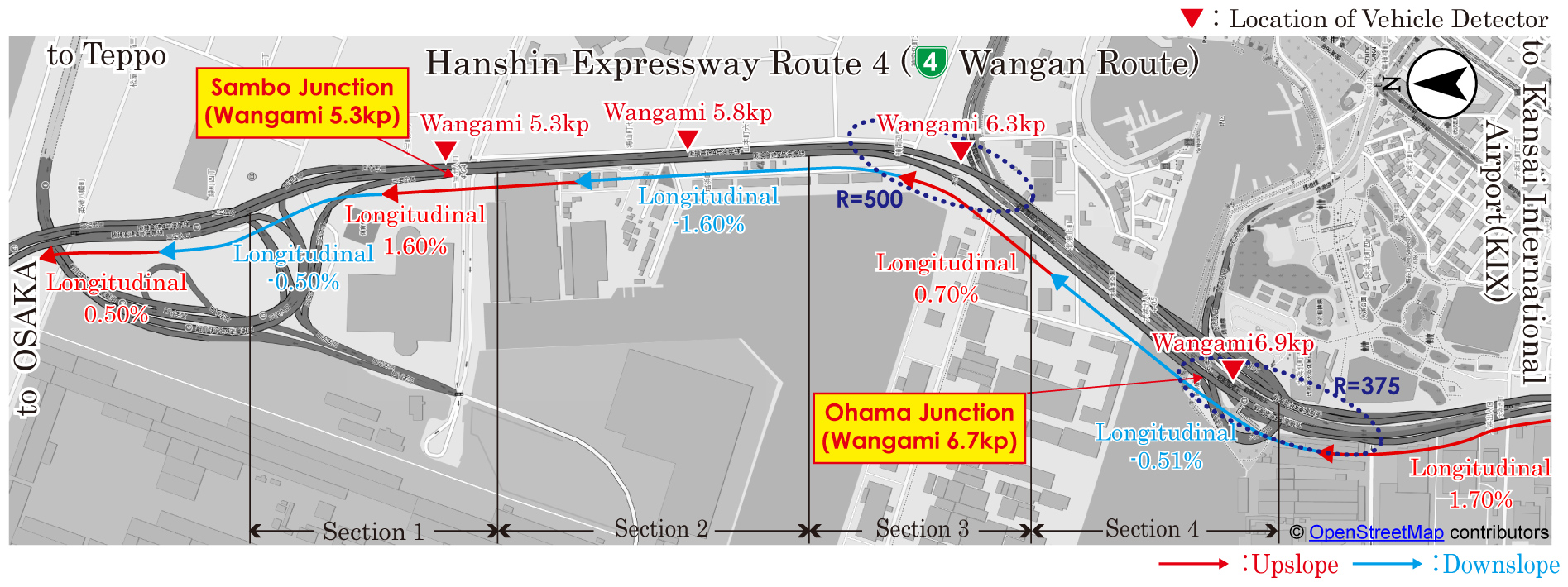
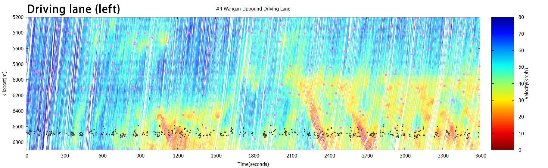
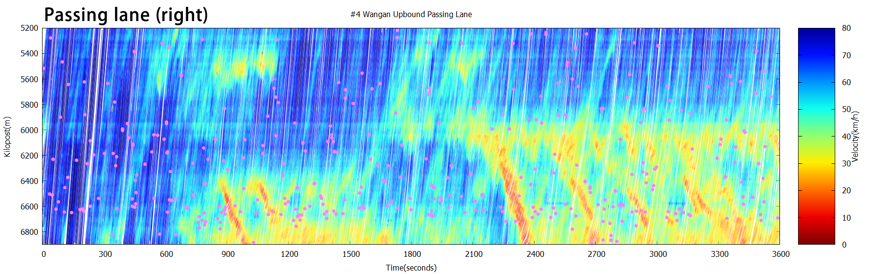
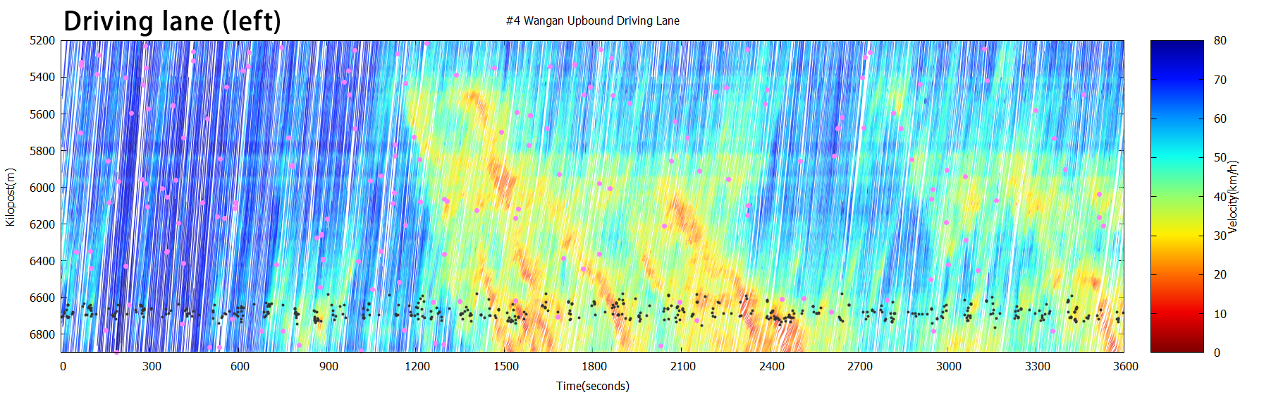
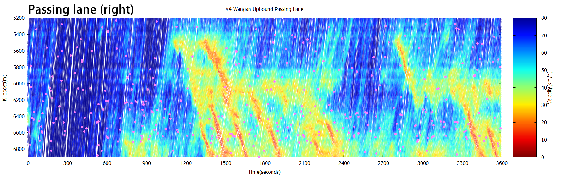
The Hanshin Expressway Route 4 (Wangan Route) is one of the major routes that connects the southern part of Osaka, including Kansai International Airport (KIX), with the center of Osaka City. It is also an access route to Yumeshima, the venue of Expo 2025 Osaka, Kansai. The traffic volume rises in the morning hours at the Ohama-Sambo section, which holds two lanes for each direction. Because of the complicated road environment such as Ohama Junction, left-hand curves, and sags, we occasionally observe shock waves at these locations.
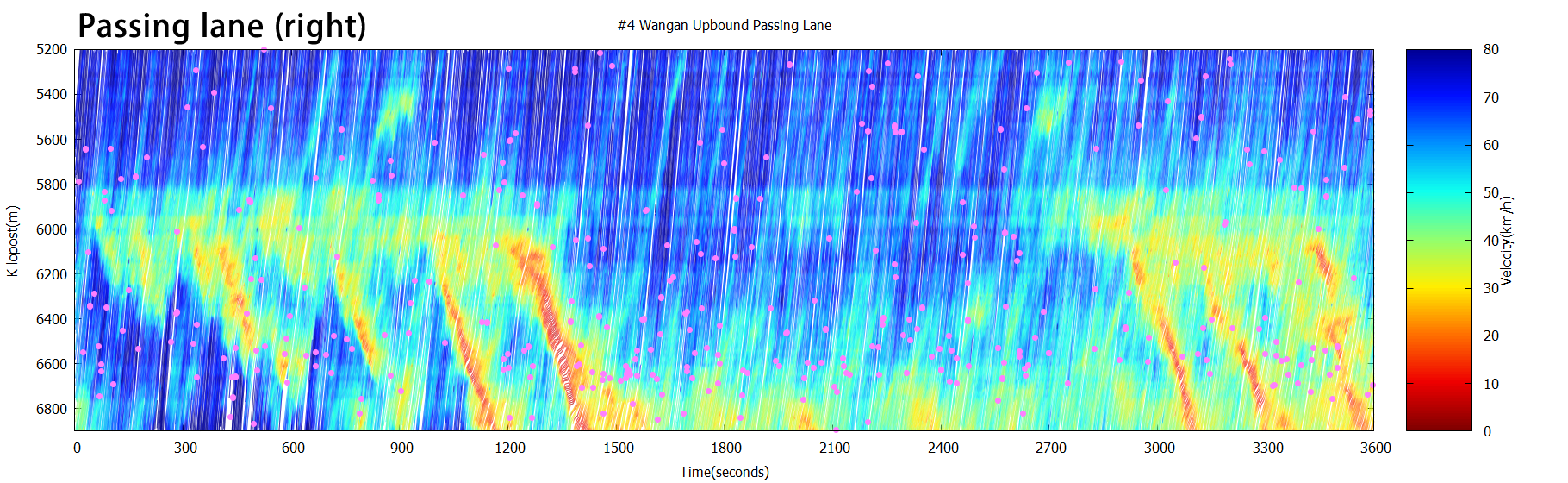
Traffic conditions in the time-space diagram
Recreated drivers’ and
birds’ views
[Driver’s view video]
[Birds’ view video]
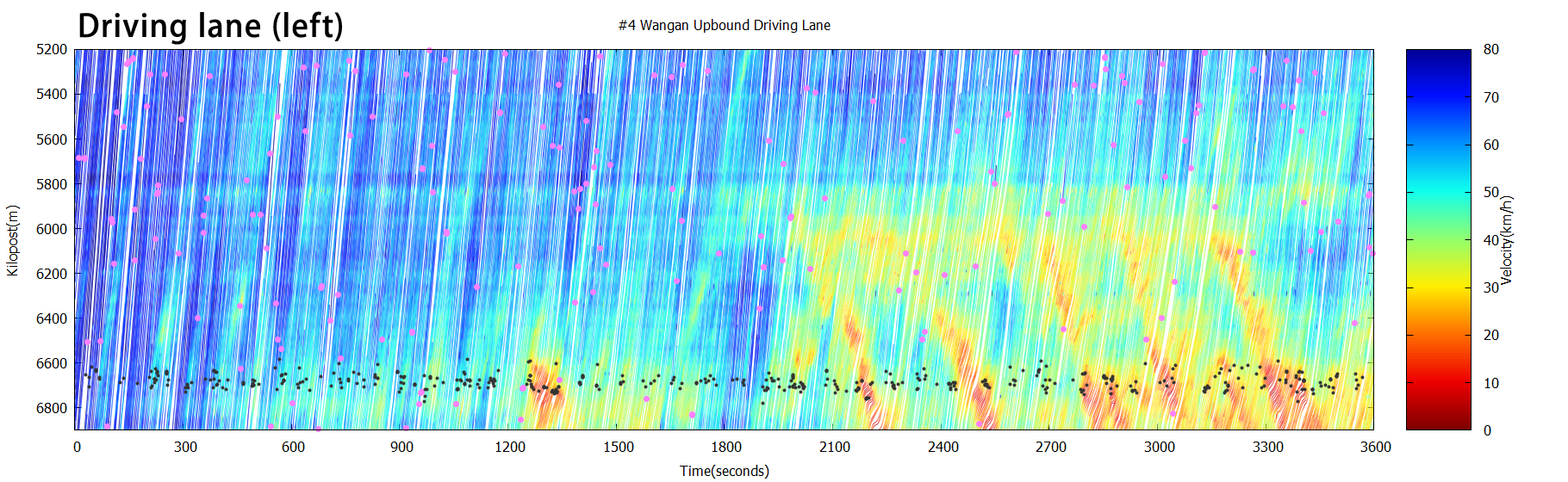
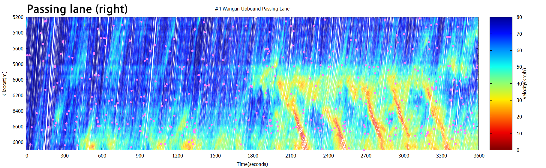
Traffic conditions in the time-space diagram
Recreated drivers’ and
birds’ views
[Driver’s view video]
[Birds’ view video]
Traffic conditions in the time-space diagram
Recreated drivers’ and
birds’ views
[Driver’s view video]
[Birds’ view video]
Traffic conditions in the time-space diagram
Recreated drivers’ and
birds’ views
[Driver’s view video]
[Birds’ view video]
Traffic conditions in the time-space diagram
Recreated drivers’ and
birds’ views
[Driver’s view video]
[Birds’ view video]
* These time-space diagrams display the traffic conditions of the five sets of one-hour “Vehicle trajectory database.”
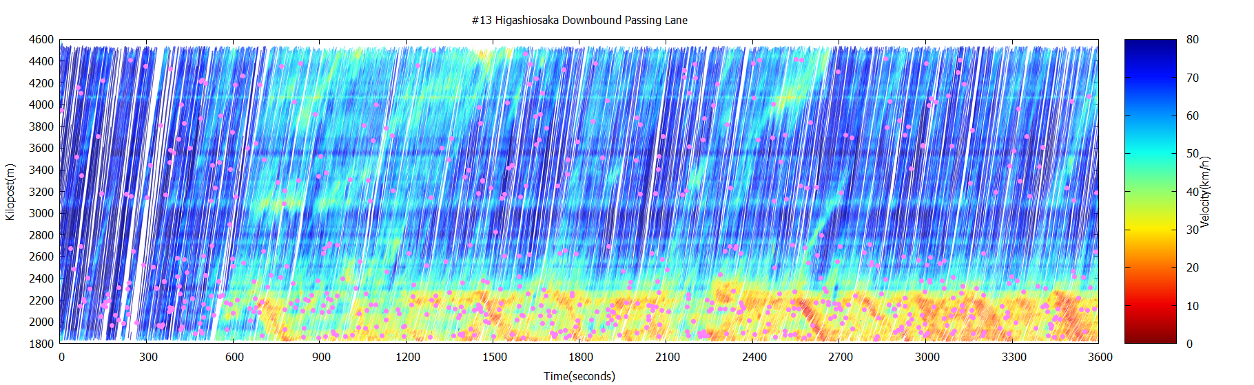
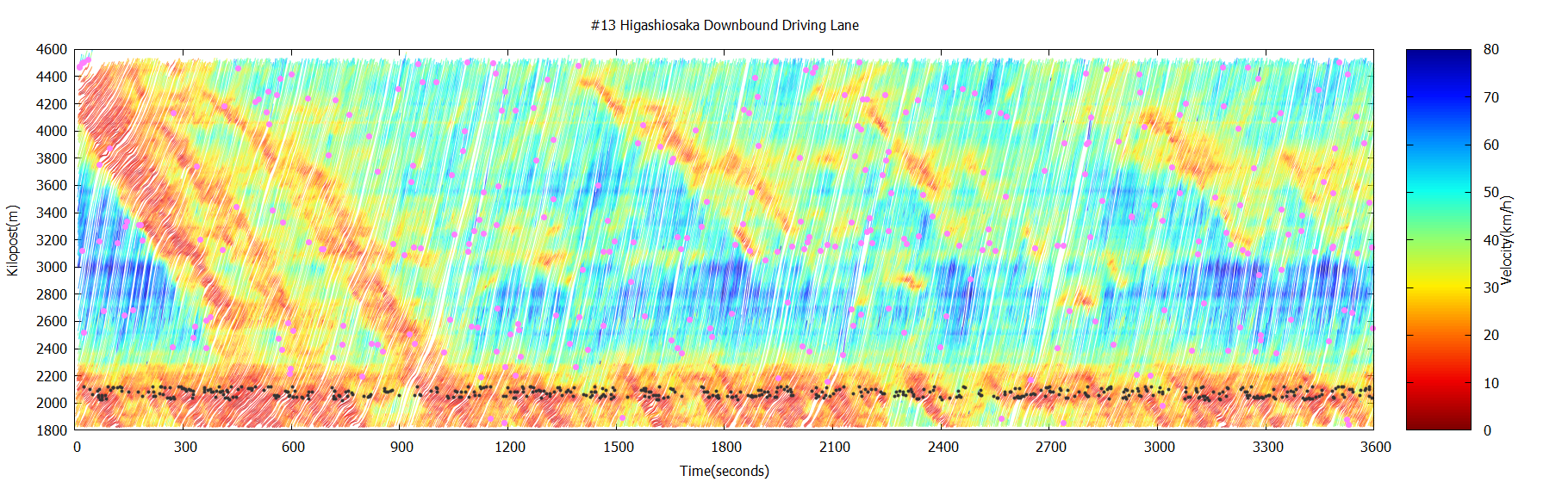
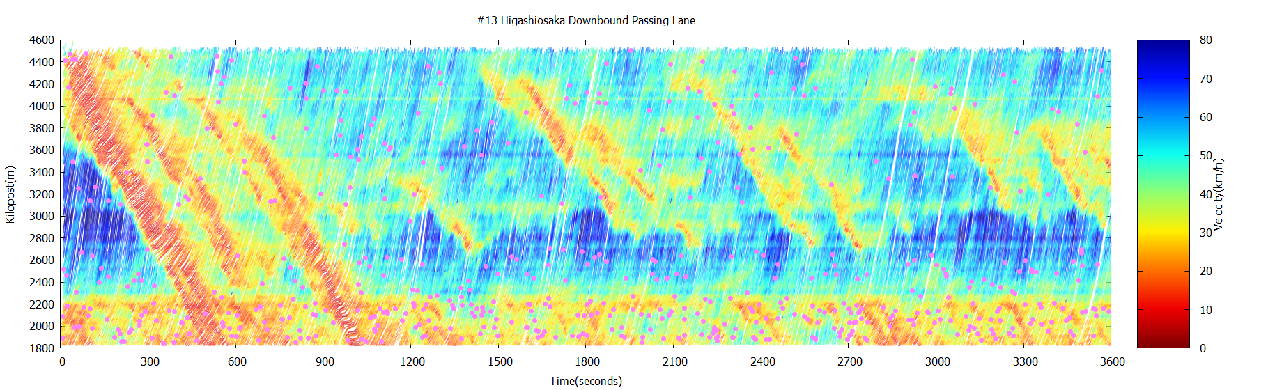
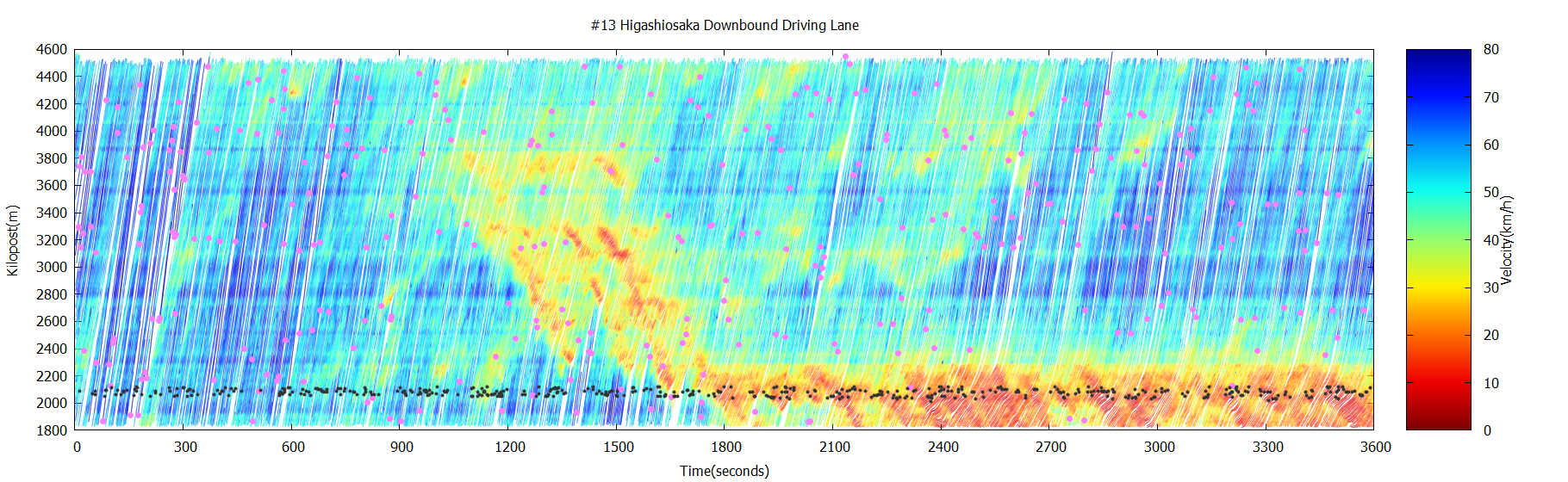
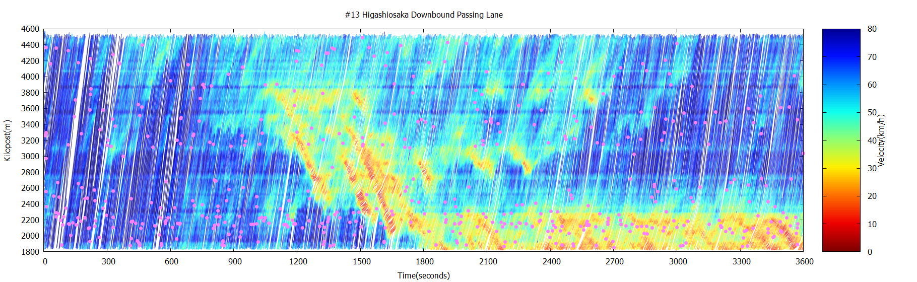
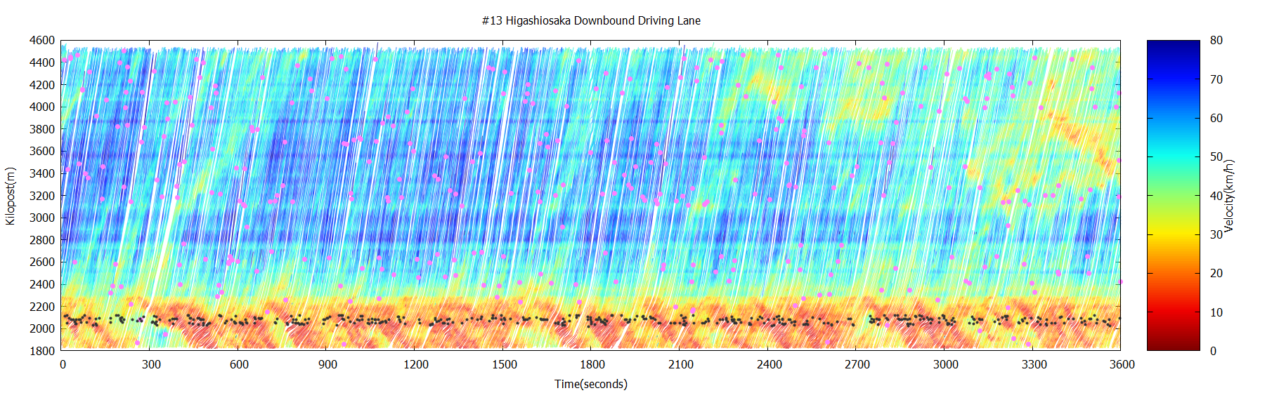
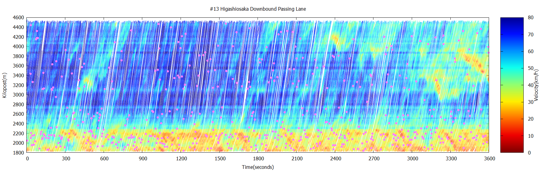
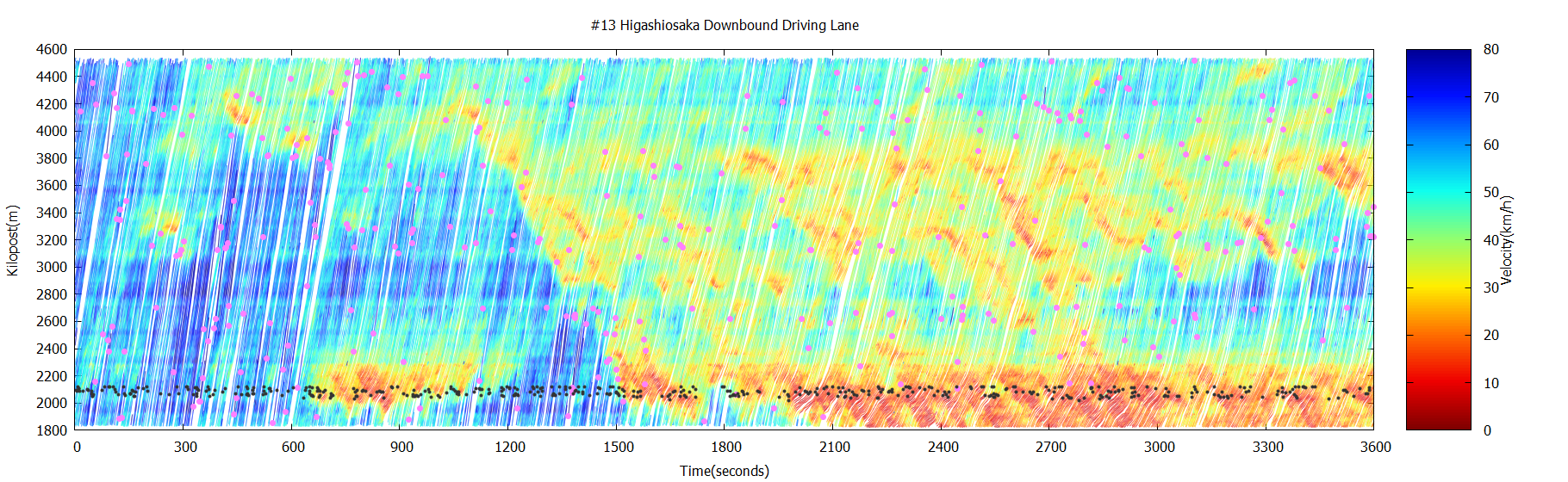
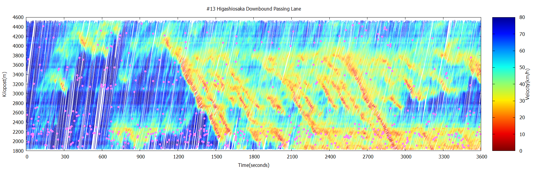
Hanshin Expressway Route 13 (Higashiosaka Route Nara bound) nearby the Morinomiya Junction
Overview of the target sections
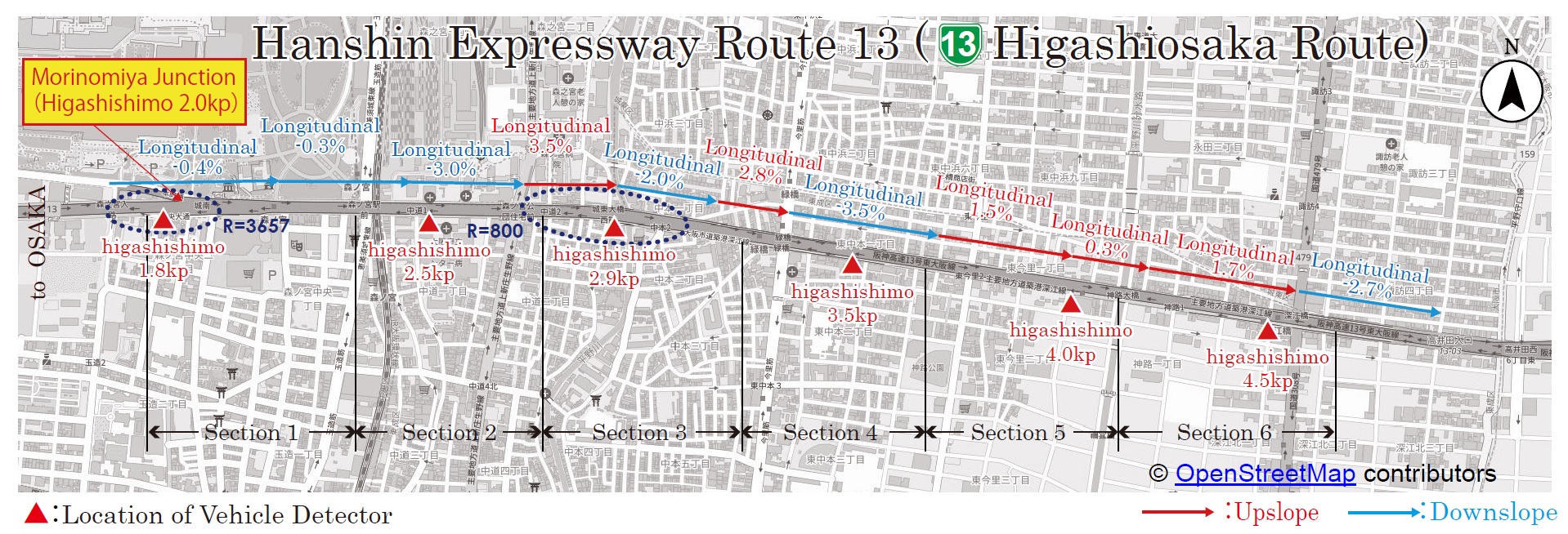
The Hanshin Expressway Route 13 (Higashi-Osaka Route) is one of the major routes that connect cities in Osaka and Hyogo regions with Nara. It holds the largest daily traffic volume within the Hanshin Expressways.
Frequent congestions are observed in the route due to their physical characteristics: several routes merge there, and gradient slopes derive speed declines. Hanshin Expressway installed a lighting system in this section to guide drivers to restore speed.
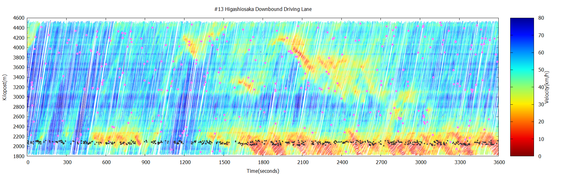
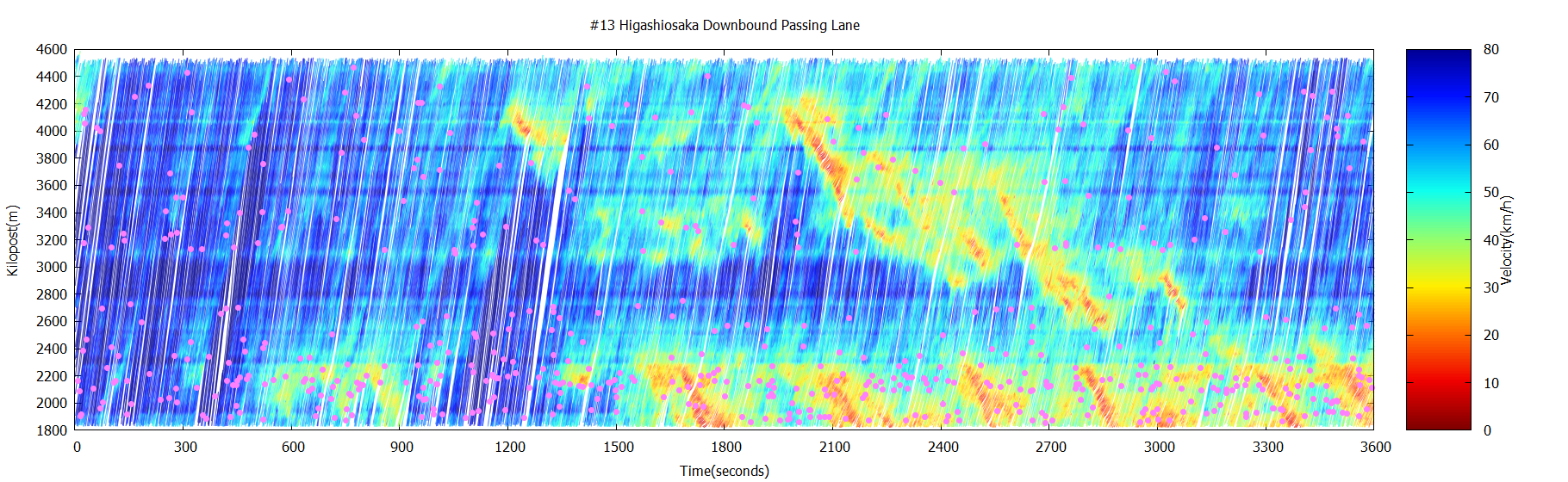
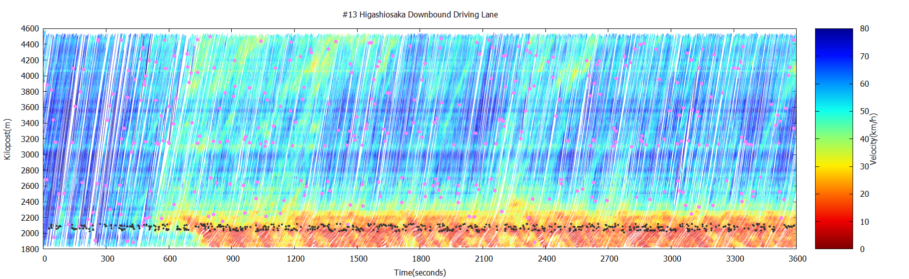
Traffic conditions in the time-space diagram
Recreated drivers’ and
birds’ views
[Driver’s view video]
[Birds’ view video]
Traffic conditions in the time-space diagram
Recreated drivers’ and
birds’ views
[Driver’s view video]
[Birds’ view video]
Traffic conditions in the time-space diagram
Recreated drivers’ and
birds’ views
[Driver’s view video]
[Birds’ view video]
Traffic conditions in the time-space diagram
Recreated drivers’ and
birds’ views
[Driver’s view video]
[Birds’ view video]
Traffic conditions in the time-space diagram
Recreated drivers’ and
birds’ views
[Driver’s view video]
[Birds’ view video]
Traffic conditions in the time-space diagram
Recreated drivers’ and
birds’ views
[Driver’s view video]
[Birds’ view video]
* These time-space diagrams display the traffic conditions of the five sets of one-hour “Vehicle trajectory database.”
Speed Restoring Guide Lights
Drivers involuntarily reduce the driving speed at road sags where the slope changes from downslope to upslope or locations where the direction of slopes changes frequently. A Speed Restoring Guide Lights System consists of lights installed in equal intervals to prevent congestion. The lights are designed to show a continuous speed flow to prompt drivers to maneuver automobiles at a consistent speed and sometimes recover speed after congestion. Hanshin Expressway continues to strive to install the system and improve the guiding patterns.
